Recreation Lakes, Trails and Rest Areas
The Ashburton / Hakatere River Trail is an easy walk or cycle which follows the Ashburton River from Melrose Road to the sea at Hakatere. The trail meanders through riverside willow and past quiet farmland. At the river mouth the trail begins at the upper picnic area overlooking the river flats near the Hakatere Huts. Along the trail there are several access points allowing sections of the trail to be enjoyed individually.
Ashton Beach Reserves are made up of multiple land parcels. The Hakatere / Ashburton River mouth is just to the east of the reserve. Originally the reserve land was obtained to provide access to the coast and the river mouth. The area is widely used for recreational activities, including fishing, bird watching, picnicking, and camping (on legal road). Fishing at the river mouth has a longstanding history, as has white baiting and surf casting.
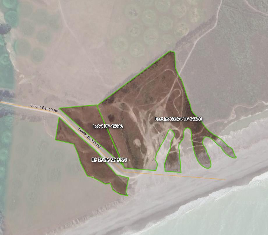
Address: 8 Lower Beach Road, Ashton
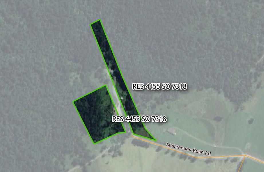
The Awa Awa Rata Reserve is a popular picnic area and an ideal day trip destination.
It is situated at the end of McLennens Bush Road at the foot of the Mt Hutt Range. It is bounded on the North West by the Pudding Hill Scenic Reserve.
The reserve is 14km from Methven and 2km from the Mt Hutt ski field turnoff and is widely known for its spring display of rhododendrons. These shrubs were first planted in 1968 in the picnic ground and have continued being planted and maintained by the Awa Awa Rata Reserve Society (Inc.). Backed by virgin native bush on the hillsides, the rhododendrons are a brilliant sight in the late spring.
The Reserve is most popular in the warmer months. The native bush provides two walking tracks which lead to either Scott's Saddle or the ridge. The reserve gives magnificent views across the Canterbury Plains.
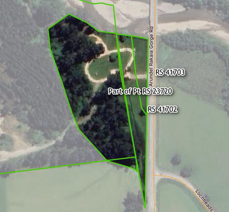
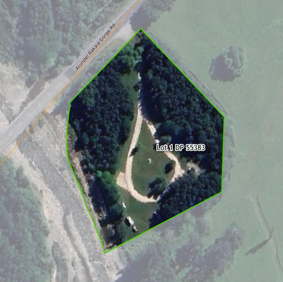
Bowyers Stream Rest Area is located on Arundel Rakaia Gorge Road south of Bowyers Stream. The north-eastern part of the open space is an Area Of Significant Conservation Value in the Ashburton District Plan. Bowyers Stream Rest Area is used for picnicking and swimming. It includes toilet facilities (new facilities in 2021) and seating. A large plantation and gravel reserve area, which is also managed by Council, is to the west.
Overnight camping in self- contained vehicles is permitted at the site.
Lake Camp (Ōtautari), formerly known as Lake Howard, is located on the southern side of Hakatere Potts Road. Lake Camp (Ōtautari) and the adjacent Lake Clearwater (Te Puna a Taka) are part of Ōtūwharekai, the area known as the Ashburton Lakes. The area is part of a special conservation area, the Hakatere Conservation Park.
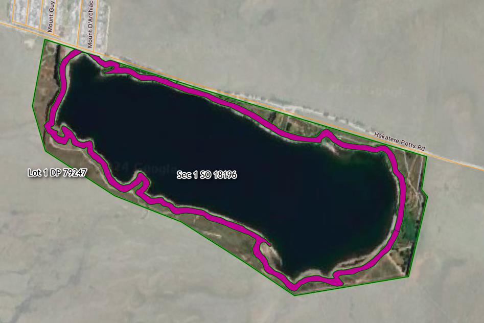
Location: Hakatere Potts Road, Lake Clearwater
- Huntingdon Ave Playground Reserve
Huntingdon Ave Playground Reserve is a 9394 m2 landscaped neighbourhood reserve which features a playground and some outdoor fitness equipment. A footpath in the reserve provides a green link through the neighbourhood and connects two reserve areas which are part of the Lake Hood Village Green Residential Development.
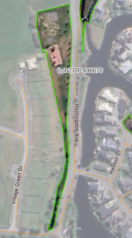
Address: Huntingdon Avenue, Lake Hood
- Huntingdon Ave to West Bay Place Walkway
Huntingdon Ave to West Bay Place Walkway is a 6012 m2 linkage reserve. A footpath in the reserve provides a green link through the neighbourhood from West Bay Place to Huntingdon Avenue, adjacent to one of the channels of Lake Hood.
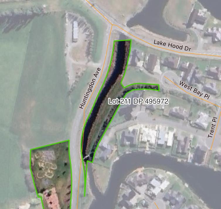
Address: Huntingdon Ave, Lake Hood
- Lake Hood Drive Reserves
Lake Hood Drive Reserves is made up of three separate land parcels, all located along Lake Hood Drive. The reserves provide access to the lake edge via walkways, as well as connections between neighbouring streets.
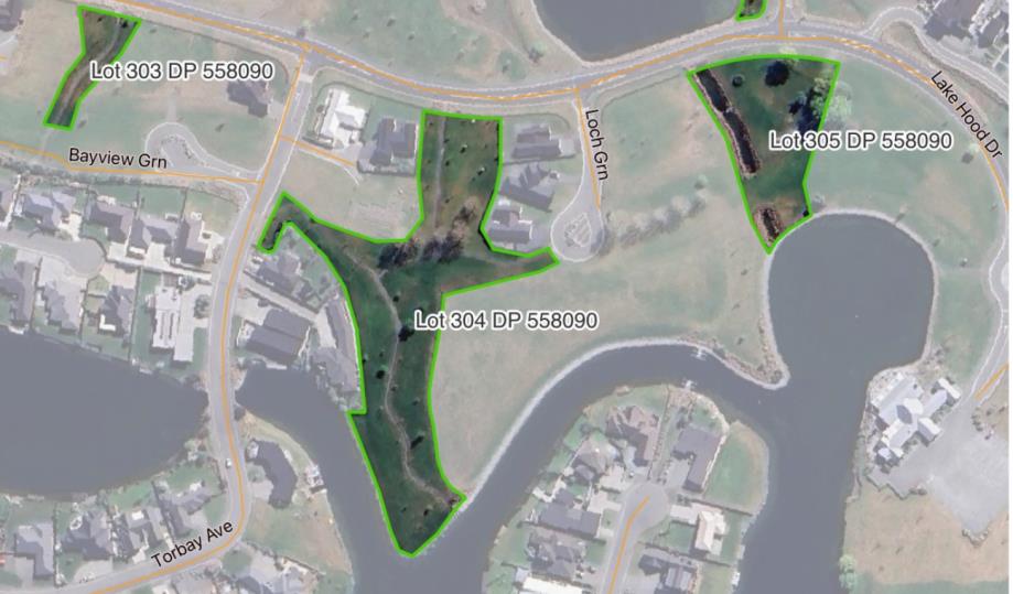
Address: Lake Hood Drive, Lake Hood
- Torbay Avenue Reserve
Torbay Avenue Reserve is recreational reserve, which provides boating access for small crafts to Lake Hood. The reserve also includes a hard stand area, with a basketball hoop. Some tree planting has been undertaken.
A portion of the reserve on the eastern boundary is used for stormwater management purposes. The reserve also contains a stand of letter boxes for 20-30 nearby properties.
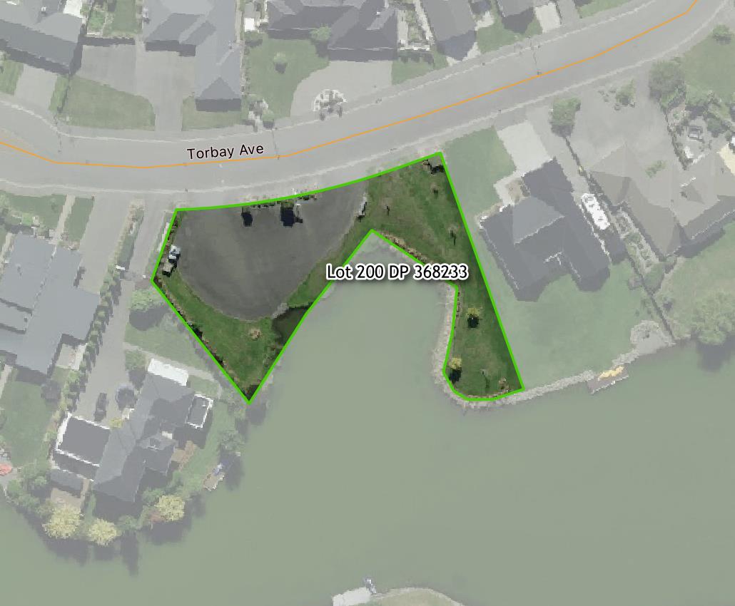
Address: 8 A Torbay Avenue, Lake Hood
- Waterton Point Parks
Waterton Point Parks is made up of three separate land parcels, which are all located along the edge of Lake Hood on Waterton Point.
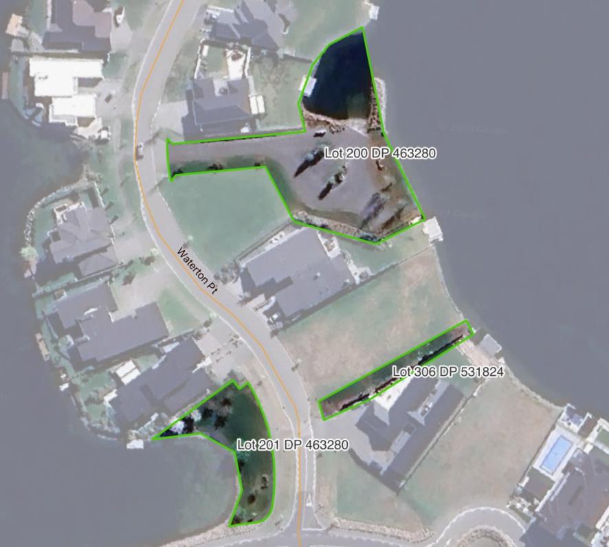
Address: Waterton Point, Lake Hood
- Witney Lane Reserves
Witney Lane Reserves is made up of three separate land parcels, which are located on both side of Witney Lane and off Halston Close. Two of the land parcels are adjacent to Lake Hood. Lot 2002 DP 311174 provides water access to the lake for small water craft.
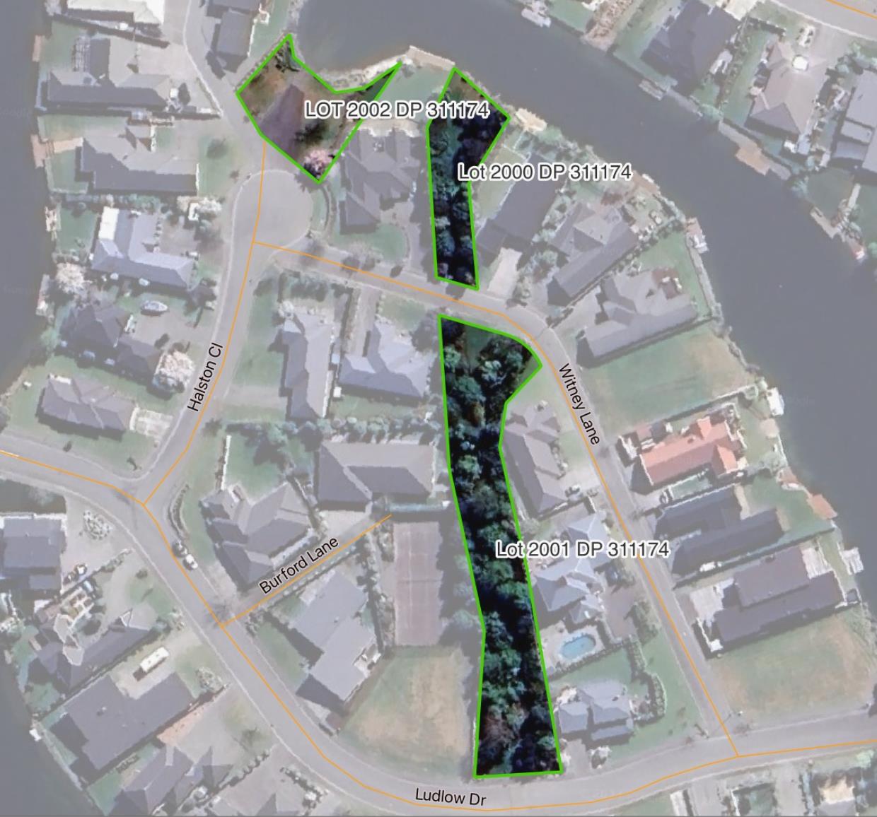
Address: Witney Lane, Lake Hood
This reserve is managed by the Hinds Reserve Board and administered by Ashburton District Council.
Lynnford Recreation Reserve is a rural reserve located to the southeast of Hinds township on the corner of Lynnford and Boundary Roads. It contains a hall which has been closed as a community facility since 2019. The reserve is managed by the Hinds Reserve Board.
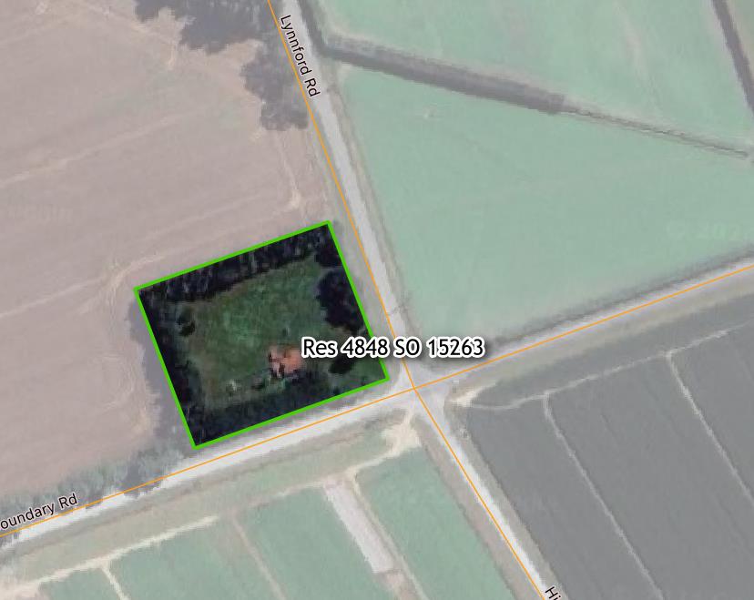
Address: 1544 Boundary Road, Hinds
This reserve is managed by the Hinds Reserve Board and administered by Ashburton District Council.
Maronan Reserve is a rural reserve located to the east of Maronan on Swamp Road. The reserve includes the former Maronan Hall, which was originally Maronan school, built in 1921. The site also contains several mature specimen trees near the Swamp Road frontage.
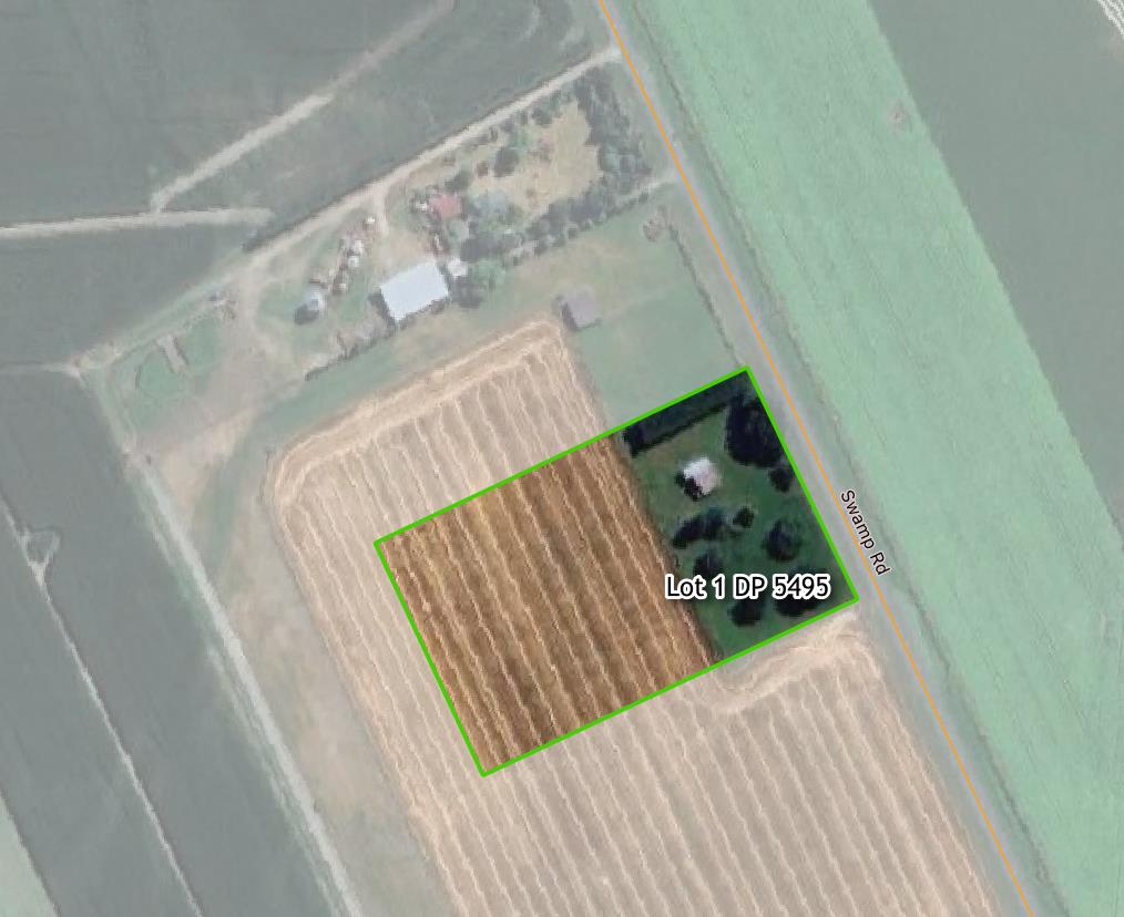
Address: 883 Swamp Road, Maronan
Rakaia Gorge contains several walking tracks and trails, parking areas and river access points. On the Ashburton side there is a camping ground and adjacent picnic area that contains public toilets and a Matariki viewing platform.
Location: Rakaia Gorge
Riverstone Park is a small accessway in the west of Rakaia. It connects the end of Eliza Way with Rakaia Domain. It contains some seating and path.
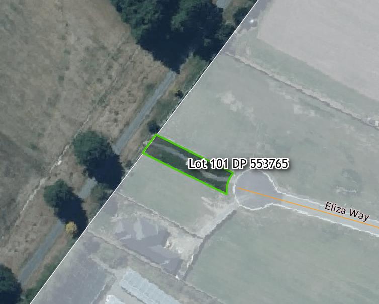
Address: Eliza Way, Rakaia
The reserve is located towards the end of Flynns Road, Staveley. Bowyers Streams is located just to the north.
The reserve is adjacent to two Crown owned reserves and the Bowyers Stream Marginal Strip to the north. The Sharplin Falls Scenic Reserve, which is managed by the Department Of Conservation, is to the northwest of the reserve.
Address: Flynns Road, Staveley
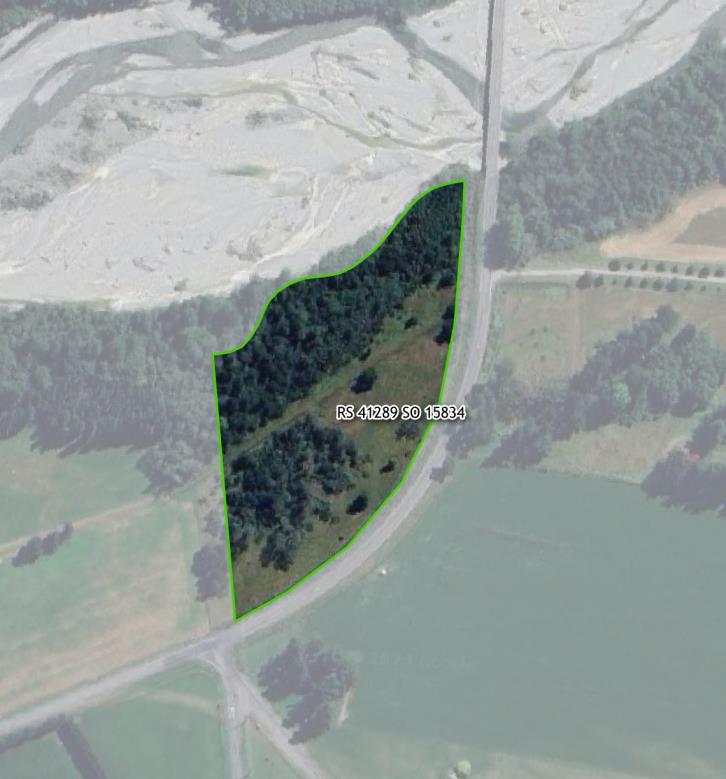
Taylors Stream Reserve is a popular rest area on the Inland Scenic Route 72. Located within the reserve are picnic facilities and a toilet.
The mature exotic trees in the reserve have been removed and significant restoration plantings have been undertaken recently.
The reserve is also used for self-contained overnight camping.
The reserve is located north of Mayfield Valetta Road opposite the intersection with Valetta Westerfield Road. It is adjacent to the South Branch of the Ashburton/ Hakatere River. The reserve is undeveloped and currently grazed. A stopbank traverses the reserve.
This reserve has limited access and is not open to the general public.
Address: Mayfield Valetta Road, Valetta
Wakanui Beach is located on the east coast of the Ashburton District, at the end of Wakanui Beach Road and north of the Hakatere / Ashburton River. The site contains significant biodiversity values, walking tracks and a new public toilet (2021). Wakanui Beach itself is not located within the reserve.
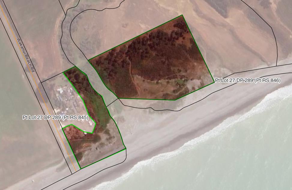
Address: 251 Wakanui Beach Road, Wakanui