May 2021 Weather Event Updates
Latest Road Closures Map:
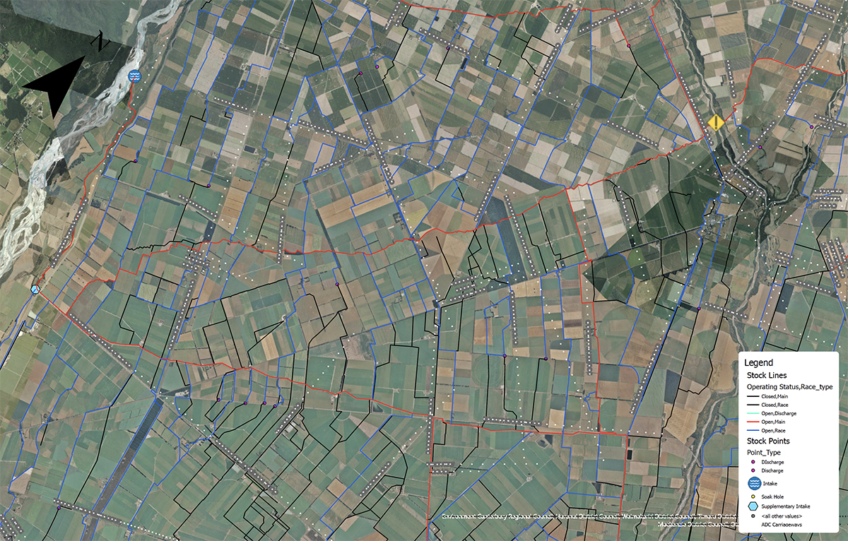
Click here to access the LIVE Ashburton District roading map
Follow this page for ongoing updates related to the MAY 2021 weather event:
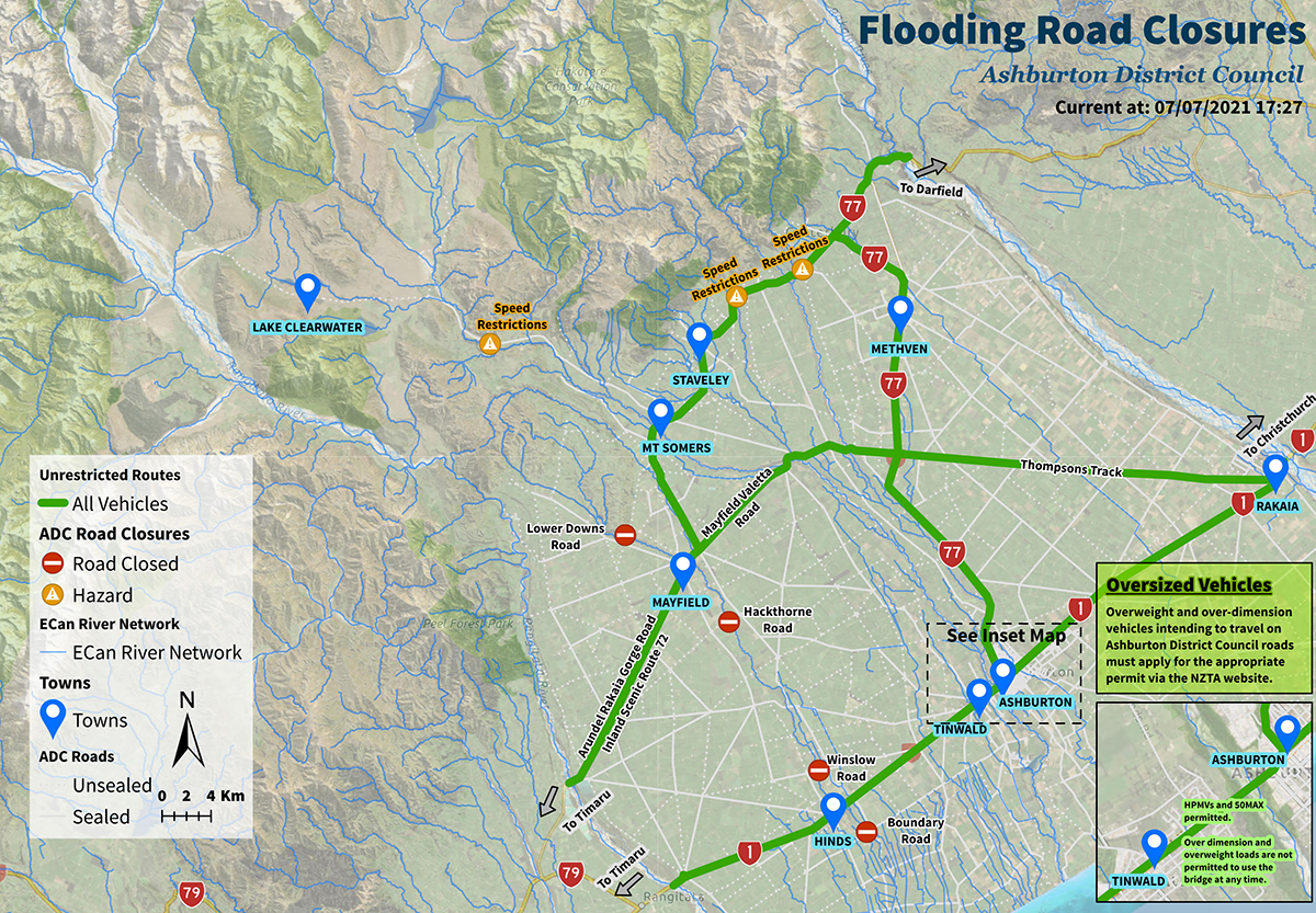
Thursday, 8 July 2021 8.00 AM
Methven Chertsey Road and River Road are now open to the public.
Double Hill Run Road is fully open for 4x4 vehicles. Please drive to the conditions.
Closed Roads
- Lower Downs Road – Mayfield Klondyke Road to Blairs Road
Impassable Sunshine Bridges (Unbridged shingle crossings over Hinds River)
- Hackthorne Road sunshine bridge
- Winslow Road sunshine bridge
- Boundary Road sunshine bridge
Monday, 5 July 2021 10.30 AM
Hakatere Potts Road and Hakatere Heron Road are now fully open. Please drive to the conditions and respect speed restrictions in place.
Repairs are currently underway on Methven Chertsey Road and River Road. These are expected to be completed over the next few days.
Closed Roads
- Lower Downs Road – Mayfield Klondyke Road to Blairs Road
4x4 Access (Residents Only)
- Blackford Rd & Double Hill Run Road – SH77 to end (Resident Access Only by 4x4)
- River Road – Beach Road East to Wakanui School Road (Resident Access Only by 4x4)
Impassable Sunshine Bridges (Unbridged shingle crossings over Hinds River)
- Hackthorne Road sunshine bridge
- Winslow Road sunshine bridge
- Boundary Road sunshine bridge
Tuesday, 29 June 2021 5.00 PM
Ashburton Staveley Road is now open between Forks Road and Springburn Bushside Road. Please respect speed restrictions in place.
Methven Chertsey Road is now open between Lyndhurst Road and Cairnbrae Road.
Closed Roads
- Lower Downs Road – Mayfield Klondyke Road to Blairs Road
4x4 Access (Residents Only)
- Blackford Rd & Double Hill Run Road – SH77 to end (Resident Access Only by 4x4)
- Hakatere Heron Road (Resident Access Only by 4x4)
- Hakatere Potts Road beyond Lake Clearwater (Resident Access Only by 4x4)
- River Road – Beach Road East to Wakanui School Road (Resident Access Only by 4x4)
Impassable Sunshine Bridges (Unbridged shingle crossings over Hinds River)
- Hackthorne Road sunshine bridge
- Winslow Road sunshine bridge
- Boundary Road sunshine bridge
Monday, 21 June 2021, 5.00 PM
Ashburton Staveley Road is currently closed between Forks Road and Springburn Bushside Road. Please avoid this area and detour around using Forks Road unless you reside in this section of Ashburton Staveley Road.
There is large amounts of surface water across the road continually flowing down from Goughs Crossing Road and Muirheads Road.
Closed Roads
- Ashburton Staveley Road (Between Forks Road and Springburn Bushside Road)
- Line Road - Winchmore Lauriston Road to Thompson Track
- Methven Chertsey Road – Cainbrae Road to Lyndhurst Road
- Lower Downs Road – Mayfield Klondyke Road to Blairs Road
- Jig Road (No Access to Mt Somers walking trails)
4x4 Access (Residents Only)
- Blackford Rd & Double Hill Run Road – SH77 to end (Resident Access Only by 4x4)
- Hakatere Heron Road (Resident Access Only by 4x4)
- Hakatere Potts Road beyond Lake Clearwater (Resident Access Only by 4x4)
- Shearers Road (Resident Access Only by 4x4)
- River Road – Beach Road East to Wakanui School Road (Resident Access Only by 4x4)
Impassable Sunshine Bridges (Unbridged shingle crossings over Hinds River)
- Hackthorne Road sunshine bridge
- Winslow Road sunshine bridge
- Boundary Road sunshine bridge
Impassable Bridges
- Ballentynes Bridge – Lower Downs Road
2.00 PM
Mayfield Valetta Road and Thompsons Track are now fully open from Rakaia through to Mayfield.
There are unsealed road sections; please respect speed restrictions in place and drive to the conditions.
Closed Roads
- Line Road - Winchmore Lauriston Road to Thompson Track
- Methven Chertsey Road – Cainbrae Road to Lyndhurst Road
- Lower Downs Road – Mayfield Klondyke Road to Blairs Road
- Jig Road (No Access to Mt Somers walking trails)
4x4 Access (Residents Only)
- Blackford Rd & Double Hill Run Road – SH77 to end (Resident Access Only by 4x4)
- Hakatere Heron Road (Resident Access Only by 4x4)
- Hakatere Potts Road beyond Lake Clearwater (Resident Access Only by 4x4)
- Shearers Road (Resident Access Only by 4x4)
- River Road – Beach Road East to Wakanui School Road (Resident Access Only by 4x4)
Impassable Bridges
- Ballentynes Bridge – Lower Downs Road
Friday, 18 June 2021, 12.00 PM
FROM Waka Kotahi NZ Transport Agency:
Ashburton River/ Hakatere Bridge, SH1, Sunday night to Monday morning closure after postponement last night
Waka Kotahi NZ Transport Agency postponed the bridge closure planned for last night over the Ashburton River/Hakatere due to wet weather conditions.
The plan was to smooth the bridge deck to enable the speed restriction to be uplifted.
The next closure is now planned for Sunday evening – 11 pm, 20 June – through to 4 am Monday morning, 21 June. The speed allowed on the bridge will remain at 30km/hour in the meantime.
If it is too wet Sunday, this bridge closure will shift to Monday night 21 June through to Tuesday morning, 11 pm to 4 am.
Please check this traffic and travel page for updates on the night: https://www.journeys.nzta.govt.nz/traffic/regions/11
Overweight and over-dimension permit vehicle drivers need to continue using the alternate local roads at this stage.
Detour route for overweight and over-dimension permitted traffic in Ashburton District here (see above).
Since the significant flooding of late May, the damaged pier had stabilised, as shown by monitoring and data analysis.
Waka Kotahi will also install electronic monitoring equipment on Sunday evening to allow remote monitoring of the structure which will avoid more traffic closures.
Timeline for repair
Waka Kotahi is aiming to complete the bridge pier repair in the next two months.
Waka Kotahi thanks all bridge users for their patience as this bridge investigation got underway and traffic management for everyone’s safety was put in place.
2.45 PM
Ashburton Gorge Road and Hakatere Potts Road are now open until Lake Clearwater for the general public.
However, the section of Hakatere Potts Road from Lake Clearwater to Erewhon Station and the entire length of Hakatere Heron Road remains closed due to further works required to rectify extensive damage from the recent floods. Updates will be provided as available.
Closed Roads
- Line Road - Winchmore Lauriston Road to Thompson Track
- Methven Chertsey Road – Cainbrae Road to Lyndhurst Road
- Lower Downs Road – Mayfield Klondyke Road to Blairs Road
- Thompsons Track – State Highway 77 to Ashburton Staveley Road
- Jig Road (No Access to Mt Somers walking trails)
4x4 Access (Residents Only)
- Blackford Rd & Double Hill Run Road – SH77 to end (Resident Access Only by 4x4)
- Hakatere Heron Road (Resident Access Only by 4x4)
- Hakatere Potts Road beyond Lake Clearwater (Resident Access Only by 4x4)
- Shearers Road (Resident Access Only by 4x4)
- River Road – Beach Road East to Wakanui School Road (Resident Access Only by 4x4)
Impassable Bridges
- Ballentynes Bridge – Lower Downs Road
17 June 2021 10.00 AM
FROM Waka Kotahi NZ Transport Agency:
Thursday night additional closure for deck repair, weather dependent, five hours proposed
As well as the Wednesday night two-hour closure, if the weather remains dry the bridge will be closed Thursday night, 17 June, 11 pm to 4 am Friday to smooth out the deck.
Check this link for updates: https://www.journeys.nzta.govt.nz/traffic/regions/11
Overweights, over-dimensions no go
Overweight and oversize permit vehicles cannot use the bridge, however, this will be updated after the Thursday night work.
4.30 PM
Council officers continue to monitor weather activity for the district and rely on MetService for warnings and alert notifications who also work closely with our relevant emergency response agencies, including the National Emergency Management Agency (NEMA).
While Council has not received any weather warnings from MetService at this stage, our Civil Defence team are discussing possible contingency plans should the district experience another significant weather event that may require a response. It is a watch and wait situation, but residents can be assured that Council is monitoring the weather closely.
MetService is New Zealand's national weather authority and the only authorised provider of Severe Weather Warnings and other public safety weather services to the people of New Zealand.
16 June 2021 3.00 PM
Closure scheduled for tonight, 11 pm 16 June, to 1 am, 17 June
Waka Kotahi has another night of monitoring and data analysis next week which will involve a two-hour closure 11 pm to 1 am, Wednesday night to Thursday morning.
“During this closure we will also be installing electronic monitoring equipment to allow remote monitoring of the structure,” says Mr Connors.
Waka Kotahi thanks all bridge users for their patience over the past week as this investigation got underway and traffic management for everyone’s safety was put in place.
Please refer to updated detour options map above for travel through the Ashburton District during this period.
Updated Road Closures
Thompsons Track and Mayfield Valetta Road are now open between Ashburton Staveley Road and Mayfield. There are unsealed road sections; please respect speed restrictions in place and drive to the conditions.
Please note that Thompsons Track remains closed between State Highway 77 and Ashburton Staveley Road to allow this section to be re-constructed after extensive damage from the floods. We are aiming to have this work completed by early next week which will allow the full route between Rakaia and Mayfield to be operational to heavy vehicles.
Ashburton Gorge Road and Hakatere Potts Road are expected to be open until Lake Clearwater by the end of the week.
The section of Hakatere Potts Road from Lake Clearwater to Erewhon Station and the entire length of Hakatere Heron Road has sustained significant damage during the recent floods. Updates will be provided as available.
Significant repairs are required on Line Road and Methven Chertsey Road due to extensive scouring from Dry Creek during the recent floods. Updates will be provided as available.
Jig Road has sustained significant damage in the floods. No public access is currently permitted along Jig Road to access the walking trails at Mt Somers.
Closed Roads
- Line Road - Winchmore Lauriston Road to Thompson Track
- Methven Chertsey Road – Cainbrae Road to Lyndhurst Road
- Lower Downs Road – Mayfield Klondyke Road to Blairs Road
- Thompsons Track – State Highway 77 to Ashburton Staveley Road
- Jig Road (No Access to Mt Somers walking trails)
4x4 Access (Residents Only)
- Blackford Rd & Double Hill Run Road – SH77 to end (Resident Access Only by 4x4)
- Ashburton Gorge Road – Stour River Bridge to Hakatere Heron Road (Resident Access Only by 4x4)
- Hakatere Heron Road (Resident Access Only by 4x4)
- Hakatere Potts Road (Resident Access Only by 4x4)
- Shearers Road (Resident Access Only by 4x4)
- River Road – Beach Road East to Wakanui School Road (Resident Access Only by 4x4)
Impassable Bridges
- Ballentynes Bridge – Lower Downs Road
11 June 2021 5.00 PM
Closed Roads
- Line Road - Winchmore Lauriston Road to Thompson Track
- Methven Chertsey Road – Cainbrae Road to Lyndhurst Road
- Lower Downs Road – Mayfield Klondyke Road to Blairs Road
- Thompsons Track – State Highway 77 to Tramway Road
- Tramway Road – Thompsons Track to Lochheads Road
- Mayfield Valetta Road –Tramway Road to Maronan Valetta Road
4x4 Access (Residents Only)
- Blackford Rd & Double Hill Run Road – SH77 to end (Resident Access Only by 4x4)
- Ashburton Gorge Road – Stour River Bridge to Hakatere Heron Road (Resident Access Only by 4x4)
- Hakatere Heron Road (Resident Access Only by 4x4)
- Hakatere Potts Road (Resident Access Only by 4x4)
- Shearers Road (Resident Access Only by 4x4)
- River Road – Beach Road East to Wakanui School Road (Resident Access Only by 4x4)
Impassable Bridges
- Ballentynes Bridge – Lower Downs Road
Impassable Sunshine Bridges (Unbridged shingle crossings over Hinds River)
- Winslow Road sunshine bridge
- Boundary Road sunshine bridge
Boil Water Notice Updates
Methven Water Supply Update: Council contractors have today continued flushing the drinking water network and while chlorine levels have continued to improve we are still not quite in a position to lift the boil water notice which remains in place. Council will again review the situation and provide another update tomorrow.
Methven-Springfield Water Supply Update: Water quality on the Methven-Springfield supply is continuing to improve but is not to the point where we can lift the boil water notice which remains in place. Council will again review the situation and provide another update on Monday.
5.00 PM
Methven Water Supply Update: Council contractors have today been flushing the drinking water network. This has improved the chlorine level but not quite enough to lift the boil water notice which remains in place. Council will again review the situation and provide another update tomorrow.
4.00 PM
Ashburton District Mayor Neil Brown has today lifted the local state of emergency for Mid Canterbury as emergency management operations transition from response to recovery mode following severe flooding.
Read the full media release...
1.40 PM
Ashburton District Council has set up two donation channels after receiving an outpouring of support from communities and individuals from all over the country, wanting to help lives and livelihoods that have been affected by recent floods.
People interested in making a financial donation can do so via an official flood relief Westpac bank account (03-1592-0521970-04) or through the Givealittle page that has been set up by Council.
Read the full media release...
10 June 2021 10.40 AM
FROM Waka Kotahi NZ Transport Agency:
Ashburton River/ Hakatere Bridge, SH1, open for freight 24/7
Waka Kotahi NZ Transport Agency’s recent monitoring and data analysis of the Ashburton River/Hakatere Bridge shows that it is safe to take trucks (up to 50MAX and High Productivity Motor Vehicles - HPMV) around the clock as of today, says Pete Connors, System Manager for Waka Kotahi.
“This is good news for truck drivers who have had much longer than normal routes around Ashburton for the past week after 7 pm and before 7 am since the drop in one bridge pier became visible after the recent floods.”
Freight vehicles have been restricted to daylight hours for the past week. Light traffic has had 24/7 access since the initial day’s closure.
The speed limit on the SH1 bridge will remain at 30km/ hour.
Overweights still no go
Overweight permit vehicles cannot use the bridge.
Timeline for repair
Mr Connors estimates repairs could be completed in the next six to eight weeks. “If we have more high river events, that could affect that timeline, but we are working as fast as we can to expedite this repair.”
Closure next Wednesday night, 11 pm, 16 June to 1 am, 17 June
Waka Kotahi has another night of monitoring and data analysis next week which will involve a two-hour closure 11 pm to 1 am, Wednesday night to Thursday morning.
“During this closure we will also be installing electronic monitoring equipment to allow remote monitoring of the structure,” says Mr Connors.
Waka Kotahi thanks all bridge users for their patience over the past week as this investigation got underway and traffic management for everyone’s safety was put in place.
Detour route for overweight permitted traffic in Ashburton District here: https://www.ashburtondc.govt.nz/news/notices-and-advisories/30-may-2021-weather-event-updates
5.00 PM
Road and Bridges Update:
Thompsons Track is now open between Rakaia and State Highway 77. The section between State Highway 77 and Maronan Valetta Road remains closed to traffic to carry out essential repairs.
RDR Bridges on Pudding Hill Road, Forks Road, Ashburton Staveley Road, and Tramway Road are not rated for HPMVs (High Productivity Motor Vehicles) and should not be used by heavy traffic passing through the district.
Route to Methven from Rakaia – Elizabeth Ave, Rakaia Barhill Methven Road, Back Track, Mt Hutt Station Road, State Highway 77
Closed Roads
- River Road – Beach Road East to Wakanui School Road
- Boundary Road – Grahams Road to the Ashburton River
- Line Road - Winchmore Lauriston Road to Thompson Track
- Methven Chertsey Road – Cainbrae Road to Lyndhurst Road
- Thompsons Track – State Highway 77 to Tramway Road
- Tramway Road – Thompsons Track to Lochheads Road
- Blackford Rd & Double Hill Run Road – SH77 to end
- Lower Downs Road – Mayfield Klondyke Road to Blairs Road
- Upper Downs Road – Hinds Gorge Road to Upper Downs Road Extension
- Ashburton Gorge Road – Stour River Bridge to Hakatere Heron Road (Resident Access Only by 4x4)
- Shearers Road (Resident Access Only by 4x4)
- Mayfield Valetta Road –Tramway Road to Maronan Valetta Road
Impassable Bridges
- Redcliffe Bridge – Double Hill Run Road
- Ballentynes Bridge – Lower Downs Road
Impassable Sunshine Bridges (Unbridged shingle crossings over Hinds River)
- Hackthorne Road sunshine bridge
- Winslow Road sunshine bridge
- Boundary Road sunshine bridge
9 June 4.20 PM
Methven residents are being advised that while the drinking water supply continues to improve, the boil water notice issued on 30 May 2021 remains in place.
A network flushing procedure is being carried out on Thursday morning, 10 June which may have localised impacts to supply pressure during the scheduled work.
Council will provide a further update on the Methven water supply tomorrow afternoon (10 June).
To receive important, free notifications about Council services in your area of the Ashburton District, including boil water notices, text your postcode to ‘4196’.
3.00 PM
FROM Waka Kotahi NZ Transport Agency:
Ashburton River/ Hakatere Bridge closing tonight for essential survey monitoring 11 pm to 1 am
Waka Kotahi NZ Transport Agency will close the Ashburton River/Hakatere Bridge tonight at 11 pm for two hours.
“The closure is needed to carry out on-going survey monitoring of the structure following the flood-related settlement last week,” says Pete Connors, System Manager Waka Kotahi.
“We will need to repeat this monitoring and two-hour closure late at night again next week, on Tuesday, 15 June 11 pm to 1 am. There may be one other night needed also, and we will advise early next week if it is confirmed.”
“We know these short notice closures are not ideal, and we have chosen a two hour slot with very low traffic numbers, but we need to restore this bridge to full strength as soon as possible so the monitoring is essential.
Repair options are currently being assessed, says Mr Connors. “We will keep the community and road users updated on this, once details are firmer.”
Background
SH1 Ashburton River/ Hakatere Bridge is open 24/7 but restricted to light vehicles (ie not trucks) overnight, between 7pm – 7am while Waka Kotahi continues to monitor the movement of the bridge.
Heavy vehicles are using a local detour at night.
Detour route for heavy traffic in Ashburton District here:
https://www.ashburtondc.govt.nz/news/notices-and-advisories/30-may-2021-weather-event-updates?fbclid=IwAR0XTyL3hqJmFNCf_7LjFEnlM3fwmQAwXmwRMuBmW0iEHo7J9xcTFRGF1Vo
8 June 1.00 PM
Feed support – Lifestyle block owners
Feed support is available for lifestyle block owners and small block holders affected by flooding in Canterbury and the drought.
The Feed Coordination Service connects farmers and contractors with surplus feed – such as hay, silage, or grazing – to people who need it.
The Feed Planning Service connects all livestock owners with an industry expert. The service can help people do a ‘snapshot feed plan’ in 20 minutes.
Both services are free and available to all livestock owners, from those on lifestyle blocks to large commercial stations.
To access feed support, call 0800 FARMING or 0800 327 646 and follow the voice prompts.
Fact sheet:
Feed support services for farmers during floods – Fact sheet (mpi.govt.nz)
Website:
Dealing with floods | MPI | NZ Government
Registration for Clean Up Help
If you think you might have an insurance claim, please contact your insurer to discuss with them, there may be more in your policy to support you during this time. FMG Clients can find more advice here
If you are in a crisis situation please call Rural Support Trust on 0800 787 254
If you are ready for assistance from volunteer help on farm - please register your needs here:
Registration for Clean Up Help (FORM)
Your registration will be passed onto coordinators matching volunteers with farmers needing help.
You may be contacted by coordinators as part of a farm recovery assessment to gain a further understanding of what support will be required to aid recovery.
9:45 AM
Rural support update: Specialist response teams consisting of Ministry for Primary Industries (MPI) and Rural Support personnel are continuing to visit farmers in affected areas to assess and provide support. If you need support, please fill out the Rural Support Needs Assessment Survey online.
If you are feeling anxious or need to talk to someone, free call or text 1737 any time for support from a trained counsellor. More advice is available from Federated Farmers.
7.30 AM
From today Ashburton Staveley Road and Forks Road will be open from 7am to 7pm. Access is for light vehicles only, which includes cars, motorcycles, mopeds, vans, people-movers, trailers including horse floats/caravans and small buses. The map above has been updated with this information.
NOTE: Thompson’s Track will remain closed for contractors to carry out repairs on dangerous sections of road.
7 June 8.30 AM
Ashburton Civil Defence emergency management activities, including recovery efforts, continue today (day 9), supported by Regional Group personnel.

5:10 PM
Afternoon Mid Canterbury! Allow me to introduce the combined Christchurch New Zealand Response Teams, who have been out around outlying areas THIS Queens Birthday weekend providing flood/river monitoring, ground evacuations, and working cordons. They are delivering food, water and medications to residents in need, as well as supporting Ashburton District Council Civil Defence emergency operations.
If you see them out and about show them some love.
Thank you response teams!


4:30 PM
Great news, the precautionary boil water notice in place for Mt Somers has been lifted! The quality of the water has returned to normal after high turbidity (cloudiness) levels were detected in the supply on 30th of May 2021. As the plant’s water quality has returned to normal and obtained three days of clear E.coli testing, residents are now safe to consume the water as normal. NOTE: Methven, Methven/Springfield & Montalto remain on boil water notice. The water in those supplies remains unsafe and must be boiled before consumption.
3:20 PM
We have had reports from residents in Road Closed areas of drivers ignoring the warning signs and continuing to use the roads. This puts further wear and tear on already damaged roads, making access harder for residents and emergency personnel.
Please note:
- Closed roads are for residents and emergency personnel only
- All other vehicles on these roads will be uninsured should damage occur
- More roads will be open tomorrow – please be patient and we will update the map above as soon as possible
10:40 AM
For farms with large amounts of debris from rivers or water ways, looking for options around disposal, please contact Environment Canterbury to discuss options before burning: 0800 324 636 ecinfo@ecan.govt.nz
You can only burn if your property is 2 hectares or larger. Please take into consideration the direction of the wind and be aware of your neighbours and nearby traffic. Burn well away from roads and put out traffic signage for vehicles where necessary.

10:20 AM
Civil Defence Payment
If you and your family are affected by an emergency event, you may be able to get a Civil Defence Payment.
Has your farm been impacted by the floods? Complete our Rural Support Needs Assessment Survey or call Ashburton Civil Defence on 03 307 7700.
Do you need financial assistance or support? Visit Work & Income - Civil Defence Payment
Rural community update - Environment Canterbury
10:10 AM
Caution before you dig: If you’re thinking about doing some works or are clearing away heavy debris that may drag into the earth, check beforeudig.co.nz who can help identify where cables, pipes and other utility assets are, in and around the proposed dig site.
9.20 AM
For farms with large amounts of debris from rivers or water ways, looking for options around disposal, please contact Environment Canterbury to discuss options before burning: 0800 324 636 ecinfo@ecan.govt.nz
You can only burn if your property is 2 hectares or larger. Please take into consideration the direction of the wind and be aware of your neighbours and nearby traffic. Burn well away from roads and put out traffic signage for vehicles where necessary.
6 June 9.00 AM
Ashburton Civil Defence emergency management activities, including recovery efforts, continue today (day 8), supported by Regional Group personnel.

2:30 PM
Canterbury Floods - Offers of Assistance Register
Farmers and the community can donate feed, grazing, volunteer time and other offers of help for Canterbury farmers through an online assistance register.
To register please go to https://fal.cn/3fRMY
Farmers Registration for Clean Up Help
If you are ready for assistance from volunteer help on farm, please register your needs below. Your registration will be passed onto coordinators matching volunteers with farmers needing help.
You may be contacted by coordinators as part of a farm recovery assessment to gain a further understanding of what support will be required to aid recovery.
Farmers can register here: https://survey123.arcgis.com/share/f040f4b4298b423299c593891e7a7299
Health and Wellbeing
If you are feeling anxious or need to talk to someone, free call or text 1737 any time for support from a trained counsellor.
5 June 9.00 AM
Ashburton Civil Defence emergency management activities, including recovery efforts, continue today (day 7), supported by Regional Group personnel.
5.00 PM
People and families in Mid Canterbury experiencing financial hardship as a result of the recent flood events will soon be able to apply for funds to help with essential costs.
Ashburton District Mayor Neil Brown has finalised the criteria for the Emergency Relief Fund which will begin accepting applications from Tuesday, 8 June. The fund is designed to assist with essential costs of daily life not covered by insurance or other funds where an immediate need exists.
Application forms and criteria will be available online from the Council website on Tuesday, 8 June.
View the full media release...
4.50 PM
Ashburton District Mayor and Ashburton District Council Chief Hamish provide an update at the end of day 6 of continued emergency management activities:
12.00 PM
Civil Defence Payment
If you and your family are affected by an emergency event, you may be able to get a Civil Defence Payment.
Has your farm been impacted by the floods? Complete our Rural Support Needs Assessment Survey or call Ashburton Civil Defence on 03 307 7700.
Do you need financial assistance or support? Visit Work & Income - Civil Defence Payment
Rural community update - Environment Canterbury
11.15 AM
Rural community flooding update: if you live in outlying areas of Ashburton and surrounding towns and have been affected by flooding, Environment Canterbury (ECan) have information on welfare, local infrastructure, flood protection infrastructure, caution when excavating, dairy moving day/ movements to winter grazing, water, correspondence, environmental compliance, milk disposal, insurance, rural finance or feed: https://www.ecan.govt.nz/your-region/farmers-hub/rural-community-update-flooding/
10.30 AM
Ashburton Civil Defence are continuing with Mid Canterbury's emergency response as the district enters day seven of the flood weather event.
Roading update: Travel across the Ashburton River Bridge on State Highway 1 remains open today with a 30km/hr speed limit, but Council is advising motorists to expect heavy congestion through Ashburton as the Queen's Birthday long weekend begins, and to set off early, if possible.
Drivers are encouraged to visit the Waka Kotahi: NZ Transport Agency website to plan travel around peak times.
Who can use the Ashburton River Bridge:
- Light vehicles are able to use the Ashburton Bridge at all hours of the day and night, while heavy vehicles can only cross it between the hours of 7am and 7pm, and must then use the alternate route at night.
- Waka Kotahi: NZ Transport Agency advise that any trucks with an 'overweight' permit need to take the alternate routes and cannot use the Ashburton River Bridge.
- The detour route for heavy vehicles is via SH77 and Inland Scenic Route / Arundel Rakaia Gorge Road. All drivers using this route must obey advised speed limits and drive with care as there is damage to the road.
Council contractors are continuing to repair rural roads, and residents are urged to be aware of hazards and drive carefully.
A map of detour routes and road closures in the Ashburton District are on the Council website.
Rural support update: Specialist response teams consisting of Ministry for Primary Industries (MPI) and Rural Support personnel are continuing to visit farmers in affected areas today to assess and provide support.
If you need support, please fill out the Rural Support Needs Assessment Survey online.
If you are feeling anxious or need to talk to someone, free call or text 1737 any time for support from a trained counsellor. More advice is available from Federated Farmers.
Boil water notices and contaminated water: Methven, Mt Somers and Methven-Springfield remain on a boil water notice due to poor water quality.
Council has lifted the shower/bathing ban on the Methven water supply, provided that residents take care not to ingest the water. The recently reinstalled water filters have improved water quality enough to make this possible.
Council is continuing to refill the water tankers stationed in Methven and Mt Somers as needed. Residents can bring clean containers along to fill for their drinking water. These tankers can be found on Main Street by the public toilets in Methven and near the Fire Station/General Store in Mt Somers.
Residents are being urged to avoid contact with potentially contaminated floodwaters, particularly below the Wilkins Road wastewater treatment ponds outside Tinwald and also Lake Hood water. Wastewater is believed to have entered Carters Creek, which feeds Lake Hood. The lake is closed until further notice.
Anyone who comes into contact with floodwaters should change out of any wet clothes and shoes and put them aside to be washed later. Wash skin that has come into contact with flood waters, and wash your hands as soon as you reasonably can – or use an alcohol-based hand sanitiser.
Caution before you dig: Council is echoing calls from Environment Canterbury for residents to be careful if they are clearing away debris. If you’re thinking about doing some works, check before U dig, who can help identify where cables, pipes and other utility assets are, in and around the proposed dig site.
Floodwater damage to homes and buildings: Ashburton District Council building inspectors are available to conduct free inspections on any homes or businesses who have sustained floodwater damage. To arrange an inspection, contact the Council on 03 307 7700.
Receive important updates by opting into the Council's free SMS/text alert service. Just text your postcode to the number 4196.
8.05 AM
Tinwald water update: The water supply problem to Tinwald properties has been resolved and affected residents should now have normal service. If you are still experiencing issues and are not receiving water, please contact Council on 03 307 7700.
4 JUNE 6.50 AM
Tinwald Water: We have just been made aware that there may be a problem with water in Tinwald. Our water team are currently investigating and we will let you know once we have more details.
10.20 PM
Roading Update:
*Traffic passing through the district should not use Thompsons Track for any part of the route due to impassable closures and significant pavement failures.
*Through traffic using Inland Scenic Route 72 should take extreme care between Waimarama Road and Ashburton Staveley Road due to significant pavement failures and excessive surface water. Please respect reduced speed restrictions in place signing these hazards on this route.
*RDR Bridges on Pudding Hill Road, Forks Road, Ashburton Staveley Road, and Tramway Road are not rated for Heavy Vehicles and should not be used by heavy traffic (to be clear, no vehicles heavier than 3.5 tonnes) passing through the district.
Route to Methven from Rakaia – Elizabeth Ave, Rakaia Barhill Methven Road, Back Track, Mt Hutt Station Road, State Highway 77
Closed Roads
*River Road – Beach Road East to Wakanui School Road
*Boundary Road – Grahams Road to the Ashburton River
*Thompsons Track – Jamiesons Road to Winchmore Lauriston Road
*Line Road - Winchmore Lauriston Road to Thompson Track
*Urrall Road – Line Road to Methven Chertsey Road
*Methven Chertsey Road – Cainbrae Road to Lyndhurst Road
*Barkers Road – Holmes Road to Back Track
*Blands Road – State Highway 77 to Thompsons Track
*Thompsons Track – State Highway 77 to Tramway Road
*Tramway Road – Thompsons Track to Lochheads Road
*Blackford Rd & Double Hill Run Road – SH77 to end
*Lower Downs Road – Mayfield Klondyke Road to Blairs Road
*Upper Downs Road – Hinds Gorge Road to Upper Downs Road Extension
*Ashburton Gorge Road – Stour River Bridge to Hakatere Heron Road
*Forks Road – Arundel Rakaia Gorge Road to Thompsons Track
*Ashburton Staveley Road – Forks Road intersection to Methven Highway 77
*Ashburton Staveley Road – Forks Road intersection Arundel Rakaia Gorge Road
*Maronan Valetta Road – Tinwald Westerfield Mayfield Road to Tramway Road
*Mayfield Valetta Road – Arundel Rakaia Gorge Road to Tramway Road
*Valetta Westerfield Road – Tinwald Westerfield Mayfield Road to Tramway Road
Impassable Bridges
*Redcliffe Bridge – Double Hill Run Road
*Ballentynes Bridge – Lower Downs Road
*Stour River Bridge – Ashburton Gorge Road
Impassable Sunshine Bridges (Unbridged shingle crossings over Hinds River)
*Hackthorne Road sunshine bridge
*Winslow Road sunshine bridge
*Boundary Road sunshine bridge
4.59 PM
Council has now lifted the shower/bathing ban on the Methven water supply, provided that residents take care not to ingest the water. The recently reinstalled filters have improved water quality enough to make this possible. A water boil notice remains in place and residents are reminded to boil water for at least 1 minute before consuming.
4.15 PM
The Methven water supply quality is improving as Council has now been able to reinstall filters that were previously removed due to complete blockage. The implications of the filters going back in will be advised shortly.
3.00 PM
Pudding Hill Rd, between Hobbs Road and Arundel Rakaia Gorge Rd, will be closed to heavy vehicles. This is to preserve Methven’s vital bridge over the RDR. Residents can move machinery along Pudding Hill Road as required, but not over the bridge.
View Ashburton District Roading Map for live updates...
1.53 PM
Residents of properties affected by flooding who wish to preform water testing of their private water supplies are encouraged to contact a water testing laboratory. Laboratories that supply this service in the Canterbury Region are Eurofins Rolleston (03 343 5227), Hills Chemistry (03 377 7176) and Analytica Laboratories (03 662 9357).
1.30 PM
12.35 PM
A number of stockwater intakes have been damaged and work is underway by Council to restore these to service. Rural landowners with stockwater races are asked to inspect all races, clear blockages, and make repairs if safe possible to do so. Damage to main races should be reported to Council immediately at 03 307 7700.
10.28 AM
Waka Kotah: NZ Transport Agency Reports:
Ashburton River/ Hakatere Bridge, SH1 – trucks allowed on bridge from 10.15 am, daytime hours only for the first week
Two days after the Ashburton River/ Hakatere Bridge was closed due a slump at one pier, the bridge has opened to more vehicles this morning, including 50MAX and high productivity permitted motor vehicles (HPMV), from 10.15 am.
The heavier vehicles will have bridge access for the first week from 7 am to 7 pm, daytime hours.
No Overweight permitted vehicles on bridge
Any trucks with an Overweight permit will need to take the alternate routes on local roads to get south of Ashburton.
The bridge was closed to traffic Tuesday morning, with pressure testing underway by the evening and light vehicles allowed back on the bridge by the end of the day. Currently light vehicles* have 24/7 access.
“The pier testing yesterday, using heavily-laden trucks, showed negligible movement, indicating that the pier has stabilised and the structure is robust,” says Pete Connors, System Manager for Waka Kotahi NZ Transport Agency.
“We still need to take it one step at a time however, particularly as the debris is being removed from underneath the bridge.
“We need to keep monitoring the bridge deck and the pier for any movement during the day. This means that we need to restrict truck movements to between 7 am and 7 pm for the next week, Thursday to Thursday (3-10 June).
“After a week of use, we need to reassess the situation and decide if we can allow broader access for the freight industry.”
- All other light traffic can use the bridge 24/7.
- If any issues arise, the bridge will close at short notice.
- Emergency services vehicles will have 24/7 access.
Pedestrian walkways reopened
The walkways down each side of the bridge will also be reopened for pedestrians and cyclists also from 10.15 am today.
30km/hour 24/7
The bridge speed limit will remain at 30km/ hour 24/7, says Mr Connors.
Repair strategy to come
At this stage, Waka Kotahi is still working through its detailed repair methodologies for this bridge pier, says Mr Connors. The fix will likely involve scour protection works, relevelling and underpinning the pier.
“Thanks to all truck drivers for your patience over the past two days and to Ashburton and Timaru District’s engineers, emergency management people and road crews who ensured alternate routes were available to get the freight through,” says Mr Connors.
Thursday 3 June - 8.00 AM
The Ashburton Emergency Operations Centre (EOC) remains active today. Civil Defence and supporting emergency agencies are working around the clock. While activities are beginning to plan for our recovery, we are still in the response stage. Today, the EOC is focusing on:
- working with Waka Kotahi: NZ Transport Agency to establish better access for heavy vehicles between Ashburton and Tinwald
- continuing to monitor river flows
- ensuring transport access through the district for supplies and support
- repairing the district's rural roads to assist local residents
- monitoring the Methven, Mt Somers and Methven-Springfield water supplies who remain on a boil water notice.
Roading update: The Ashburton River Bridge on SH1 remains open to light vehicles. There is a 30km speed limit across the bridge. The heavy vehicle detour through the district also remains open via Arundel Rakaia Gorge Road / Inland Scenic Route and SH77. There is damage along this route, particularly between Ashburton Staveley Road and Forks Road, so please obey the signposted speed limits and drive with care.
Rural support: Specialist response teams consisting of Ministry for Primary Industries (MPI) and Rural Support personnel will continue visiting farmers in the most affected areas today to assess and provide support. If you need support, please fill out the Rural Support Needs Assessment Survey online. If you are feeling anxious or need to talk to someone, free call or text 1737 any time for support from a trained counsellor.
Water update: Methven, Mt Somers and Methven-Springfield remain on a boil water notice, due to poor water quality. The heavy rainfall impacted the quality of the water at the weekend and residents should boil their water for at least 1 minute before consuming. Council is continuing to refill the water tankers stationed in Methven and Mt Somers as needed. Please bring along clean containers to fill for drinking water. The tankers are located on Main Street near the public toilets in Methven, and near the Fire Station/General Store in Mt Somers.
All residents are reminded to avoid coming into contact with floodwaters, and to assume it is contaminated. This is particularly so for the area below the Wilkins Road wastewater treatment ponds outside Tinwald where wastewater has mixed with floodwaters. Additionally, Lake Hood is closed for recreation and residents at Lake Hood are reminded to avoid contact with the lake water. Wastewater from the Ashburton treatment facility has flowed into the lake via Carters Creek.
Anyone who comes into contact with floodwaters should change out of any wet clothes and shoes and put them aside to be washed later. Wash skin that has come into contact with flood waters, and wash your hands as soon as you reasonably can – or use an alcohol-based hand sanitiser.
Receive important updates:
Ongoing information on the flood weather response is being posted on the Ashburton District Council website.
To opt-in to the Council's free SMS/text alert service, text your postcode to the number 4196.
Need to report an issue or help?
For emergencies, please call 111 first to access applicable emergency services.
For all other urgent support and assistance enquiries, contact the Council on 03 307 7700.
If you are feeling anxious or need someone to talk to, free call or text 1737 for support.
8.45 PM
The SH1 / Ashburton River Bridge is open for light vehicles only. An alternate route through the Ashburton District is available for heavy vehicles:
[See revised map above]
5.25 PM
Ashburton District Mayor Neil Brown and Ashburton District Council Chief Executive Hamish Riach drive over temporary re-opened SH1 / Ashburton River Bridge and provide an update on emergency management activities...
4.15 PM
Waka Kotahi – NZTA reporting that the Hinds River Bridge is now open to all traffic, with 50km/h speed limit restrictions in place.
3.08 PM
WAKA KOTAHI: NZTA - Following a prior closure, the Ashburton River Bridge is now open to light vehicles only with a 30km/h temporary speed restriction in place. Please note, this section of road is scheduled to close again between 6pm- 8pm on Wednesday 2nd June for further inspections. Plan your journey accordingly.
See below alternate route for heavy vehicles. Please continue to take care on our roads and reduce speeds as advised.
1.30 PM
Ashburton District Mayor Neil Brown provides an update on continued emergency management activities and road closures/detours:
11.50 AM
SH1 / Ashburton Bridge is now closed for further testing and inspection. An alternate route is available for all travelers trying to get through the Ashburton District, however, ONLY ESSENTIAL TRAVEL IS ADVISED due to significant delays on this route as a result of increased traffic. All drivers using this route must obey advised speed limits and drive with care. Follow updates at https://bit.ly/3pda6yY
11.00 AM
Revised alternate route map:
[See latest map above]
10.25 AM
CLARIFICATION RE METHVEN WATER SUPPLY: The Methven-Township water supply has plenty of water available in its reservoirs. However, due to the recent weather event, this water supply remains under a boil water notice due to poor water quality. The advisory to avoid using water for showering and bathing is out of health and safety precaution, as unintentionally ingesting poor quality water can lead to illness. Potable drinking water is available from the water tanker on the Main Street by the public toilets. We will let you know when the situation improves.
9.40 AM
Ashburton Civil Defence are continuing with Mid Canterbury's response and recovery as the district enters day five of the flood weather response.
Roading
Travel through the Ashburton District is continuing today with a rural detour established and limited access over the SH1 Ashburton Bridge available until 10am this morning, but motorists are being advised that travel is slow and to consider if they really need to travel as there may be construction works and unexpected hazards.
Light and medium sized vehicles have been able to cross the Ashburton Bridge since last night, after Waka Kotahi: NZ Transport Agency conducted load tests and the bridge is scheduled to shut again for further load testing from 10am to at least 2pm today.
Heavy vehicles are being directed via SH77 to Methven and onto the Inland Scenic Route 72 to get through the district. All drivers using this route must obey advised speed limits and drive with care. The detour adds significant time to usual travel times, and drivers should expect delays. Council is encouraging people to avoid non-essential travel at this time.
Receding waters are allowing contractors to assess road conditions and damage. Repairs are continuing on closed roads, and as more become safe to travel on, Council will update its roading map on the website.
Emergency services
Emergency services are continuing to provide support throughout the district. Anyone requiring emergency assistance should call 111, and for other support, contact Ashburton Civil Defence on 03 307 7700.
Rural support
Ministry for Primary Industries (MPI) and Rural Support are assisting Civil Defence to provide support for the district's farming community. Teams have begun visiting affected farms to assess stock feed needs and damage to farm infrastructure.
Any rural property owners needing advice or support are urged to contact Ashburton Civil Defence on 03 307 7700.
Boil water notices and contaminated water
Boil water notices remain in place for Methven, Mt Somers and Methven-Springfield. Water tankers are being refilled to ensure there is safe drinking water for Methven and Mt Somers. These tankers can be found on Main Street by the public toilets in Methven and near the Fire Station/General Store in Mt Somers.
Residents are being urged to avoid contact with potentially contaminated floodwaters, particularly below the Wilkins Road wastewater treatment ponds outside Tinwald and also Lake Hood water. Wastewater is believed to have entered Carters Creek, which feeds Lake Hood. The lake is closed until further notice.
Anyone who comes into contact with floodwaters should change out of any wet clothes and shoes and put them aside to be washed later. Wash skin that has come into contact with flood waters, and wash your hands as soon as you reasonably can – or use an alcohol-based hand sanitiser.
Floodwater damage to homes and buildings
Ashburton District Council building inspectors are available to conduct free inspections on any homes or businesses who have sustained floodwater damage. To arrange an inspection, contact the Council on 03 307 7700.
Receive important updates:
Ongoing information on the flood weather response is being posted on the Ashburton District Council website.
To opt-in to the Council's free SMS/text alert service, text your postcode to the number 4196.
Need to report an issue or help?
For emergencies, please call 111 first to access applicable emergency services.
For all other urgent support and assistance enquiries, contact the Council on 03 307 7700.
If you are feeling anxious or need someone to talk to, free call or text 1737 for support.
7.00 AM
2 JUNE 2021, 5.00 AM
Ashburton Bridge Planned Closure: We are reminding residents that Waka Kotahi is closing the Ashburton Bridge this morning from 10am to 2pm. The closure is to complete the load testing, which will inform the long-term solutions for the bridge. Please plan your day accordingly, the map below (from 8.40pm last night) shows alternate routes while the bridge is closed.
11.45 PM
Light vehicles alternate routes
Now that the Ashburton Bridge is open to light vehicles, people travelling south of Tinwald to Rangitata have two options. Waka Kotahi has an unsealed detour route around Hinds. Council has a sealed route available, which uses Longbeach Road, Poplar Road and Ealing Road, as shown on the maps below. Heavy vehicles are to continue to use the alternate route announced earlier. Please continue to take care on our roads and reduce speeds.
[See latest map above]
11.25 PM
Ashburton Bridge Update
Great news – We have just been informed by Waka Kotahi that the Ashburton Bridge has temporarily re-opened. The bridge will have two-way traffic, restricted to 30km/hour in each direction. Only light vehicles can travel on the bridge – to clarify, light vehicles are considered to weigh less than 3.5 tonnes, your typical car, ute or van.
Ashburton District Mayor Neil Brown says Waka Kotahi, Civil Defence and contractors have been working hard all day to re-establish safe access routes for people stranded on either side of the bridge.
"This is very welcome progress, and my thanks goes to all who have made this possible. The engineers are satisfied that the bridge can now support limited traffic movement to allow people to safely cross."
The bridge will close again tomorrow (Wednesday 2 June) between 10am and 2pm for further investigative work. Heavy traffic vehicles are to use the alternate route listed below.
8.40 PM
We have established an alternate route detouring around the closed Ashburton Bridge. Civil Defence and contractors have been working hard all day to re-establish safe access. Road conditions are variable therefore we recommend all motorists reduce speed to 60 kilometre per hour. Care needs to be taken as there are several single-lane bridges on the route.
The route is as follows:
- Transitioning through the district use the Inland Scenic Route 72 and follow signs
- To travel north or south from Tinwald use the Tinwald Westerfield Mayfield Road to connect to the Inland Scenic Route 72
- To travel north or south from Ashburton (north of the Ashburton River), use State Highway 77 to Methven and then connect with the Inland Scenic Route 72
- For residents needing to cross the bridge (Ashburton - Tinwald or Tinwald - Ashburton), the alternate route is State Highway 77, Inland Scenic Route 72 and Tinwald Westerfield Mayfield Road (or vice versa). This will take over an hour so please check your fuel levels before travelling
[See latest map above]
7.40 PM
Update to Methven Water: Unfortunately due to the recent weather event, the Methven water supply remains under a boil water notice. Water quality is poor, and while we have seen improvements, there is still a way to go. This means that residents should avoid using the water for showering and bathing. Potable drinking water is available from the water tanker on the Main Street by the public toilets. We will let you know when the situation improves.
6.30 PM
Ashburton District Mayor Neil Brown and Ashburton District Council Chief Executive Hamish Riach provide an update on the SH1 / Ashburton Bridge closure...
4.00 PM
Need somewhere to stop for a cuppa or toilet? The New Life Church (58 Melcombe Street, Tinwald), Baptist Church (67 Cass Street, Ashburton) and Hakatere Marae (439 Rakaia Highway, Fairton) are available if you are stuck and need somewhere to stop for refreshments.
The SH1 Ashburton Bridge (between Ashburton and Tinwald) remains CLOSED for the foreseeable future.
2.00 PM
Mayor Neil Brown welcomed Prime Minister Jacinda Ardern along with Member for Rangitata Jo Luxton, Agriculture and Rural Affairs Minister Damien O’Connor, Acting Emergency Management Minister Kris Faafoi and Canterbury CDEM Group Controller Neville Reilly to the Ashburton Emergency Operations Centre earlier today, where they were to briefed on the ongoing Civil Defence emergency response.

1.06 PM
The SH1 Ashburton Bridge (between Ashburton and Tinwald) remains closed including alternate through roads. THERE IS NO DETOUR ROUTE THROUGH ASHBURTON DISTRICT AT THIS TIME. Council contractors are working to potentially open an access route later today. Limited access is being managed for authorised/emergency vehicles only. There is no current public access. If you require immediate welfare assistance, please call 03 307 7700 or 111 in case of emergency.
We have been advised that Kiwi Rail are going to assess the possibility of using the rail bridge to shuttle supplies across.
10.45 AM
SH1 / Ashburton Bridge update: The Ashburton Bridge on SH1 (the bridge that links Ashburton to Tinwald) remains CLOSED for the foreseeable future. Please do not queue at the bridge, as access is not possible at this time. Council is urgently working to establish an alternate route and it is anticipated that this route will open later today. Emergency services are continuing to assist Civil Defence and these services are available for anyone who requires urgent support. In an emergency, please call 111. For other support call Ashburton Civil Defence on 03 307 7700.
Roading update: Council is urgently working to establish access routes through the district and these are anticipated to be open TODAY. Please ensure you are signed up to the Council's text/SMS alert service to receive these updates, by texting your postcode to the number '4196'.
Several roads and bridges remain closed throughout the district or are impacted by water damage. Please check Council's road closure map for more information. ESSENTIAL TRAVEL ONLY. Please avoid travelling if you can.
Route to Methven from Ashburton - SH77, Winchmore Lauriston Rd, Dromore Methven Rd, Pole Rd, Cainbrae Rd, Line Rd
Route to Methven from Rakaia - Rakaia Barhill Methven Road, Back Track, SH77
Route across the Hinds River - Maronan Road single lane bridge – OPEN. Poplar Rd Bridge - OPEN
Closed Roads
- Thompsons Track – From SH77 Road to Mayfield Valetta Road
- Thompsons Track – From Jamiesons Road to Winchmore Lauriston Road
- Tramway Road – From Thompsons Track to Locheads Road
- Arundel Rakaia Gorge Road – From Tinwald Westerfield Mayfield Road to Pudding Hill Road
- Blackford Rd & Double Hill Run Road – From SH77
- Ashburton Gorge Road – from Stour River Bridge to Hakatere Potts Road
- Barkers Road – between Holmes and Back Track Road
- Lyndhurst Road – Between Line Road and Methven Chertsey Road
- Methven Chertsey Road - between McCloys Road and Urrall Road
- Forks Road – Between Arundel Rakaia Gorge Road and Thompsons Track
- Lowerdowns Road – Between Mayfield Klondyke and Blairs Road
- Anama Settlement Road – Between Mayfield Klondyke and Blairs Road
- River Road – From Beach Road East to Wakanui School Road
- Boundary Road – From Grahams Road to the Ashburton River
Closed bridges
- Redcliffs Bridge – Double Hill Run Road
- Pudding Hill Bridge – Arundel Rakaia Gorge Road
- Ballentynes Bridge – Lowerdowns Road
- Stour River Bridge – Ashburton Gorge Road
- Hackthorne Road sunshine bridge
- Winslow Road sunshine bridge
- Boundary Road sunshine bridge
Animal welfare update: An animal welfare centre is set up for anyone who needs assistance with their pets or animals. If you are separated from your pets and are unable to go home at this time, in the first instance, please check if a neighbour or nearby friend can check on them for you. If this is not possible, please call Animal Welfare on 03 307 7700.
9.25 AM
- The Council office, Ashburton Library, Ashburton Resource Recovery Park and EA Networks Centre are OPEN. The EA Networks Centre is operating with limited personnel, and this has meant swim lessons for today are cancelled. Fitness classes may also be virtual instead of instructor led.
- Ashburton Museum remains CLOSED to visitors.
- Rubbish and recycling kerbside collection has resumed as normal today (1 June).
- Residents in Methven, Mt Somers, Mayfield, Tinwald and Lake Hood whose bins were not collected on Monday are advised that their next collection is scheduled for Monday 7 June. Access to many of these areas is still limited, but Council is investigating what options might be available as this Civil Defence event progresses.
9.00 AM
Ashburton Bridge / Alternate route update: Ashburton District Council is continuing to assess potential alternate routes around the Ashburton Bridge on SH1 that is now CLOSED.
6.55 AM
There is now no need to prepare for evacuation as the threat of evacuation has passed. Residents in Ashburton, particularly in the vicinities of Allenton, Netherby, and Racecourse Road were previously advised to prepare for evacuation in case the Ashburton River stopbanks breached. Data shows the Ashburton River flow has receded considerably overnight, and residents can now settle back as there is no longer any need to prepare for evacuation.
6.50 AM
State Highway 1 / Ashburton Bridge has been compromised due to severe weather and is NOW CLOSED.
There is currently no alternate route south as all other road options are closed.
Council contractors continue to investigate road conditions and will provide updates when available.
1 JUNE 2021, 5.20 AM
We have no updates for you from here within the Emergency Operation Centre as it has been an uneventful night. The Ashburton River has continued to subside overnight and currently has a flow rate of 470m3 at the Ashburton Bridge (peak in the event was 1,448m3).
8.30 PM
Update to Ashburton River: The Ashburton River flow conditions are continuing to show improvement. Here at Civil Defence, we will be keeping a close watch on this overnight. While the risk of evacuation is lowering, we still encourage you to be prepared with your grab-bag packed should the situation change over night.
7.50 PM
State Highway update: Waka Kotahi will be opening the Selwyn River Bridge on SH1 from 8pm-11pm tonight to allow traffic through.
6.50 PM
Ashburton District Mayor Neil Brown and Ashburton District Council Chief Executive Hamish Riach provide another update on emergency management activities:
5.35 PM
The Blairs Grill syphon under the South Hinds River on the Brothers Stockwater Main has been damaged. Stockwater supply to downstream customers could be impacted by this damage so these customers should make alternative arrangements for their stockwater.
4.48 PM - Roads and Bridges Update
Route to Methven from Ashburton
- Ashburton - SH77 – Winchmore Lauriston Rd – Dromore Methven Rd – Pole Rd –Cainbrae Rd – Line Rd – Methven
Route to Methven from Rakaia
- Rakaia – Rakaia Barhill Methven Road – Back Track – SH77 - Methven
Route Across the Hinds River
- Maronan Road single lane bridge – Open
- Poplar Rd Bridge - Open
Updated Road Closures
- Thompsons Track – From SH77 Road to Mayfield Valetta Road
- Thompsons Track – From Jamiesons Road to Winchmore Lauriston Road
- Tramway Road – From Thompsons Track to Locheads Road
- Arundel Rakaia Gorge Road – From Intersection of Tinwald Westerfield Mayfield Road to Pudding Hill Road
- Ashburton Staveley Road – Between SH77 and Thompsons Track
- Blackford Rd & Double Hill Run Road – From SH77
- Ashburton Gorge Road – from Stour River Bridge to Hakatere Potts Road
- Barkers Road – between Holmes and Back Track Road
- Lyndhurst Road – Between Line Road and Methven Chertsey Road
- Methven Chertsey Road - between McCloys Road and Urrall Road
- Forks Road – Between Arundel Rakaia Gorge Road and Thompsons Track
- Lowerdowns Road – Between Mayfield Klondyke and Blairs Road
- Anama Settlement Road – Between Mayfield Klondyke and Blairs Road
- River Road – From Beach Road East to Wakanui School Road
- Boundary Road – From Grahams Road to the Ashburton River
- Upper downs Road – from Hinds Gorge to Brothers Road
Bridges
4 Bridges confirmed to be damaged/completely unpassable.
- Redcliffs bridge – Double Hill Run Road
- Pudding Hill Bridge – Arundel Rakaia Gorge Road
- Ballentynes Bridge – Lowerdowns Road
- Stour River Bridge – Ashburton Gorge Road
3 sunshine bridges all completely unpassable
- Hackthorne Road
- Winslow Road
- Boundary Road
Additional sever damage to roads
- Thompsons Track between Ashburton Staveley rd and Tramway Road
- Upper downs road culverts
- Double Hill run Road (land slips)
- Methven chertsey Road (water scouring from dry creek)
- Potts river culvert (washed out by river)
4.30 PM
Rubbish and recycling services will resume as per their normal schedule on Tuesday, 1 June 2021. The Ashburton Resource Recovery Park will also be open as per normal operating hours.
4.00 PM
River flow update: Civil Defence continues to monitor the Ashburton River stopbanks. While flow conditions are improving, residents are encouraged to be prepared for an evacuation, should this be needed. In the event of an evacuation, Civil Defence will issue a mass mobile alert to mobile phones in the affected area. You do not need to do anything to receive this alert.
For more information about what a mass mobile alert is, see here.
If an evacuation order is issued, Civil Defence will provide instructions on where evacuated residents can go.
3.00 PM
Methven & Mt Somers water update: The water tankers in Methven and Mt Somers are being refilled this afternoon, and are scheduled to be refilled again from 7am tomorrow morning (1 June). In Methven, the water tanker is located near the public toilets on Main Street, while the Mt Somers tanker is located near the Fire Station/General Store.
Bring along containers to fill for your drinking water. If you are unable to get to the tankers to access the water, please call Ashburton Civil Defence on 03 307 7700.
Welfare information: There are currently NO evacuation orders in place for the Ashburton District. Residents are urged to have a grab-bag ready to go in case of evacuation. If you need to self-evacuate, consider if there are friends or family that you can stay with. If you don't have somewhere safe to go, please contact Ashburton Civil Defence on 03 307 7700.
Water contamination: Residents are reminded to continue avoiding floodwater, as wastewater from the Ashburton pond treatment facility on Wilkins Road, Tinwald has flooded. Potentially contaminated water is now mixing with floodwater downstream from Wilkins Road. This is a public health risk. Additionally, wastewater is flowing into Carters Creek which feeds Lake Hood. Residents should avoid the water and assume that it is contaminated. If you do come into contact with flood waters, change out of any wet clothes and shoes and put them aside to be washed later. Wash skin that has come into contact with flood waters, and wash your hands as soon as you reasonably can – or use an alcohol-based hand sanitiser.
Media briefing: Watch the latest update from Mayor Neil Brown, taken from inside the Ashburton Emergency Operations Centre at 2.30pm today:
1.30 PM
Ashburton Bridge update: Waka Kotahi: NZ Transport Agency are advising that the Ashburton Bridge on SH1 remains OPEN at this time, however the pedestrian walkway along the bridge is CLOSED.
Please avoid all non-essential travel.
For more information on state highway access and closures, visit the Waka Kotahi: NZ Transport Agency website.
12.00 PM
Media briefing: Ashburton District Mayor, Neil Brown will be holding a media briefing at 2.30PM today, 31 May at the Emergency Operations Centre in Ashburton.
To watch the briefing, tune into the Council Facebook page @AshburtonDC.
The briefing had previously been advised as happening at 2PM but it has been pushed back to 2.30PM.
9.45 AM
Contaminated floodwater update: Wastewater from the Ashburton wastewater treatment system near Wilkins Road may be flowing into Carters Creek. Carters Creek feeds into Lake Hood. As previously advised, people should avoid all floodwater and assume that it is contaminated.
If you do come into contact with floodwaters, change out of any wet clothes and shoes and put them aside to be washed later. Wash skin that has come into contact with floodwaters, and wash your hands as soon as you reasonably can – or use an alcohol-based hand sanitiser.
- Information from Community & Public Health can be found here
- Further advice on managing safely and cleaning up after flooding can be found here
9.30 AM
Road closure map: Details of local road closures in the Ashburton District can be found here
8.30 AM
Mount Somers water update: A potable water tanker has arrived in Mount Somers. The tanker is located near the Fire Station/Mt Somers General Store. Bring along containers for your household drinking water.
Council facilities update: The Ashburton Museum, Library and EA Networks Centre remain CLOSED today. The Ashburton Resource Recovery Park will be OPEN. Please avoid travelling if you can.
To receive important text message alerts for your area of the Ashburton District (for free), text your postcode to ’4196’.
8.15 AM
Contaminated floodwater: The Ashburton wastewater pond treatment facility at Wilkins Road has flooded. Potentially contaminated water is now mixing with floodwater downstream from Wilkins Road (outside Tinwald). This is a public health risk. People should avoid all contact with floodwater and assume is it contaminated.
If you do come into contact with flood waters, change out of any wet clothes and shoes and put them aside to be washed later. Wash skin that has come into contact with flood waters, and wash your hands as soon as you reasonably can – or use an alcohol-based hand sanitiser.
- Information from Community & Public Health can be found here
- Further advice on managing safely and cleaning up after flooding can be found here
7.00 AM
Methven-Springfield water supply: Ashburton District Council has issued a precautionary boil water notice, effective immediately, for the Methven-Springfield water supply due to high turbidity at the treatment plant.
Residents connected to this scheme are advised to boil their drinking water, water used in food preparation, and for hygiene purposes for at least one minute before consumption.
The precautionary boil water notice will remain in place until further advised.
Update to Mt Somers residents: We are currently organising for a water tanker to bring potable drinking water to Mt Somers. We will advise residents of when this will be available. In the meantime, continue to boil water.
31 MAY 2021, 3.30 AM
Update on road conditions: We currently have 19 roads closed throughout the district and it is likely that a number more are severely affected. Three bridges have collapsed or been washed away, with a number more also affected.
Our district will look quite different in the morning so we are urging residents to:
- Stay safe and stay home wherever possible
- If you must go out, assume that dark patches on the road are water, and if the water is over the road think twice before driving through
- In urban areas, slow down when driving through water so as not to create a bow-wave for neighbouring properties
We will be out at first light assessing the damage on our roading network.
Update on bridge closures:
- Arundel Rakaia Gorge Road (Route 72) - between Forks Rd and Pudding Hill Rd
- Double Hill Run Road (Redcliffe Stream)
- Lower Downs Road (Ballantynes Bridge) - Mayfield Klondyke Rd to Blairs Rd
11.30PM
The Canterbury District Health Board have released the following flooding-related public health advice.
10.15 PM
Hinds Township Update: The Hinds Township has been cut-off from flooding in the Hinds River. Residents are self-evacuating as necessary. If you do not have anywhere to go, the Southern Rugby Clubrooms is on stand-by. Please call 03 307 7700 if you need help.
Updated Road Closures:
- Melcombe Street - between SH1 and Buckleys Terrace
- Thompsons Track – From Ashburton Staveley Road to Mayfield Valetta Road
- Thompsons Track – From Jamiesons Road to Winchmore Lauriston RoadT
- Tramway Road – From Thompsons Track to Locheads Road
- Arundel Rakaia Gorge Road – From Intersection of Tinwald Westerfield Mayfield Road to Pudding Hill Road
- Ashburton Staveley Road – Between SH77 and Forks Road
- Blackford Rd & Double Hill Run Road – From SH77
- Ashburton Gorge Road – from Stour River Bridge to Hakatere Potts Road
- Barkers Road – between Holmes and Back Track Road
- Lyndhurst Road – Between Line Road and Methven Chertsey Road
- Methven Chertsey Road - between Lyndhurst Road and Line Road
- Forks Road – Between Arundel Rakaia Gorge Road and Ashburton Staveley Road
- Mt Hutt Station Road – Between SH77 and SH77
- Lowerdowns Road – Between Mayfield Klondyke and Blairs Road
- Anama Settlement Road – Between Mayfield Klondyke and Blairs Road
- River Road – From Beach Road East to Wakanui School Road
Sunshine Bridge closures:
- Hackthorne Rd – Between Barford Rd and Lismore Mayfield Road
- Winslow Rd – Between Swamp Rd and Hinds Lismore Road
- Boundary Rd – Between Isleworth and Lynnford Road
8.30 PM
Ashburton evacuation update: There is currently NO evacuation order in place for Ashburton. We are still keeping a close watch on the Ashburton River stopbanks and will continue to monitor this overnight. As a precaution, please have a grab-bag ready to go in case of evacuation.
In the event of an evacuation, Civil Defence will issue a mass text alert to mobile phones in the affected area. You do not need to do anything to receive this alert.
For more information about what a mass text alert is, see here.
8.00 PM
Update on Animal Welfare Centre: We have established an animal welfare centre in Ashburton. If you need assistance for your pets, please call 03 307 7700.
Update on Methven Water: ACL water tankers will be in Methven tomorrow morning from 7am outside the public toilets on Main Street. Bring along containers to fill for your household drinking water.
5.19 PM
Update on Methven an Mt Somers water supplies: Due to difficulty running treatment in current conditions, plants are running without any filtration at all. Water quality will be very poor particularly for those connected to Methven water scheme. Water boil for these two schedule remains in place.
3.55 PM
Updated Road Closures:
- Thompsons Track – From Ashburton Staveley Road to Mayfield Valetta Road
- Thompsons Track – From Jamiesons Road to Winchmore Lauriston Road
- Tramway Road – From Thompsons Track to Locheads Road
- Arundel Rakaia Gorge Road – From Intersection of Tinwald Westerfield Mayfield Road to Pudding Hill Road
- Ashburton Staveley Road – Between SH77 and Thompsons Track
- Blackford Rd & Double Hill Run Road – From SH77
- Ashburton Gorge Road – from Stour River Bridge to Hakatere Potts Road
- Barkers Road – between Holmes and Back Track Road
- Lyndhurst Road – Between Line Road and Methven Chertsey Road
- Methven Chertsey Road - between Lyndhurst Road and Highbank Cairnbrae Road
- Forks Road – Between Arundel Rakaia Gorge Road and Thompsons Track
- Mt Hutt Station Road – Between SH77 and SH77
- Lowerdowns Road – Between Mayfield Klondyke and Blairs Road
- Anama Settlement Road – Between Mayfield Klondyke and Blairs Road
- River Road – From Beach Road East to Wakanui School Road
Sunshine Bridges
- Hackthorne Rd – Between Barford Rd and Lismore Mayfield Rd
- Winslow Rd – Between Swamp Rd and hinds Lismore Rd
- Boundary Rd – Between Isleworth and Lynnford Rd
View live road closures mapping data...
3.42 PM
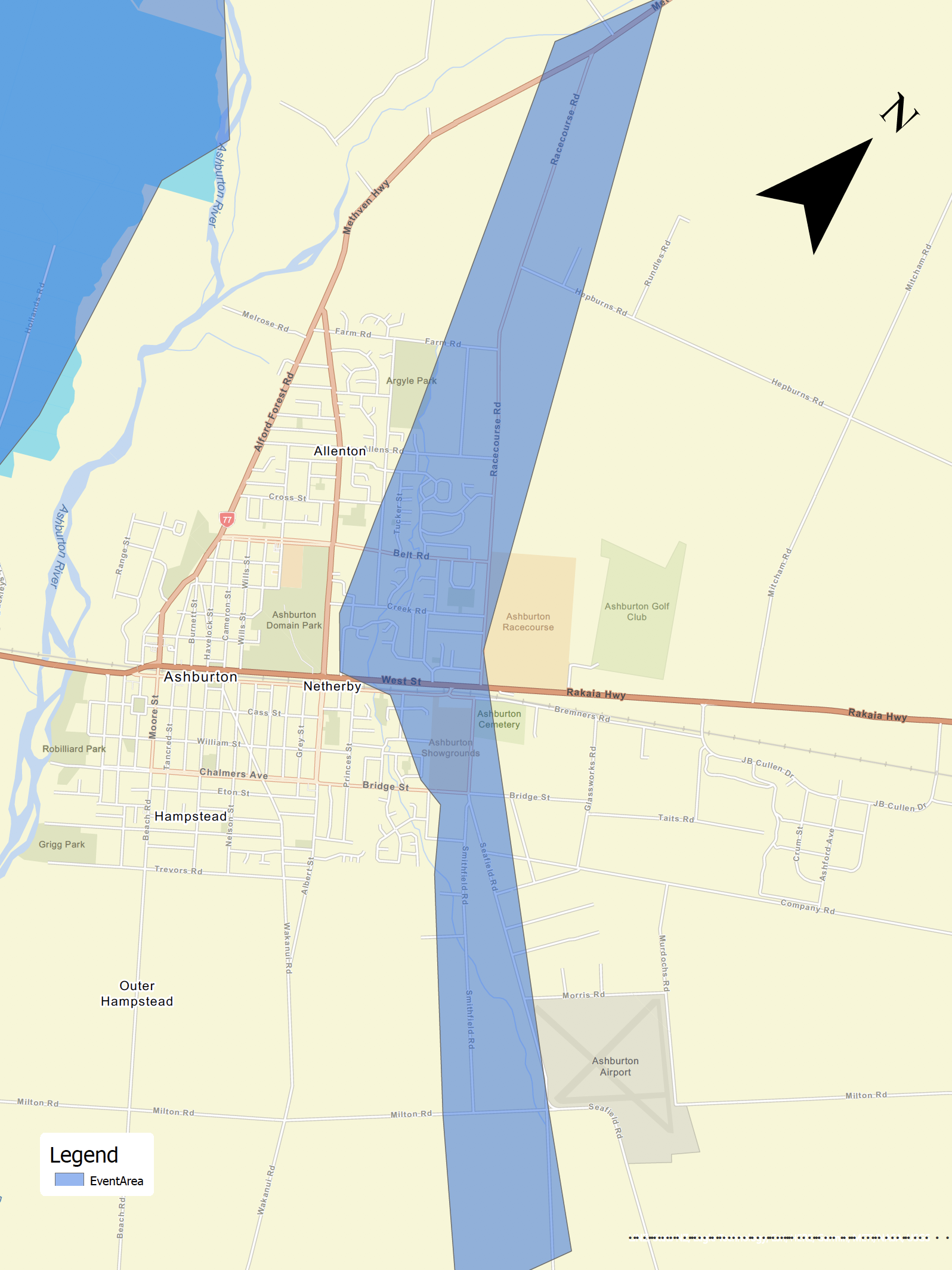
Ashburton District Council is advising residents in Ashburton, particularly in the vicinities of Allenton, Netherby, and Racecourse Road, to prepare for evacuation as a precautionary measure should there be a breach in Ashburton River stopbanks. While no decision has made to evacuate as of yet, residents should get ready and plan for an evacuation upon official notice. More information to come.
Potential flooding area:
3.00 PM
Ashburton District Council has cancelled curb side rubbish and recycling services for Monday, 31 May 2021.
2.55 PM
Updated Road Closures:
- Thompsons Track – From Ashburton Staveley Road to Mayfield Valetta Road
- Thompsons Track – From Jamiesons Road to Winchmore Lauriston Road
- Tramway Road – From Thompsons Track to Locheads Road
- Arundel Rakaia Gorge Road – From Intersection of Tinwald Westerfield Mayfield Road to Pudding Hill Road
- Ashburton Staveley Road – Between SH77 and Thompsons Track
- Blackford Rd & Double Hill Run Road – From SH77
- Ashburton Gorge Road – from Stour River Bridge to Hakatere Potts Road
- Barkers Road – between Holmes and Back Track Road
- Lyndhurst Road – Between Line Road and Methven Chertsey Road
- Methven Chertsey Road - between Lyndhurst Road and Highbank Cairnbrae Road
- Forks Road – Between Arundel Rakaia Gorge Road and Thompsons Track
- Mt Hutt Station Road – Between SH77 and SH77
Sunshine Bridges
- Hackthorne Rd – Between Barford Rd and Lismore Mayfield Rd
- Winslow Rd – Between Swamp Rd and hinds Lismore Rd
- Boundary Rd – Between Isleworth and Lynnford Rd
2.30 PM
Media Briefing:
1.33 PM
Media briefing scheduled for 2.15 PM with Ashburton District Mayor Neil Brown, and Minister of Justice, Minister for Broadcasting and Media, and Minister of Immigration, Kris Faafoi.
12.30 PM
- Heavy rain is expected until 1500 Monday 31 May 2021.
- The North branch (Digbys Bridge) and South branch (Valletta) of the Ashburton River is expected to reach capacity by mid morning. Prep work has been done to the South by creating channels where water can be redirected. Stobanks and river levels continue to be monitored by ECan.
- Contractors continue to review road conditions and manage closures.
- Hakatere Marae have been mobilised and are preparing for Welfare needs.
12.10 PM
Updated road closure:
- Ashburton Staveley Road – Between SH77 and Thompsons Track
11.46 AM
Updated road closures:
- Thompsons Track – From Ashburton Staveley Road to Mayfield Valetta Road
- Tramway Road – From Thompsons Track to Locheads Road
- Arundel Rakaia Gorge Road – From Intersection of Tinwald Westerfield Mayfield Road to Forks Road
Updated sunshine bridges closures:
- Hackthorne Rd – Between Barford Rd and Lismore Mayfield Rd
- Winslow Rd – Between Swamp Rd and hinds Lismore Rd
- Boundary Rd – Between Isleworth and Lynnford Rd
11.00 AM
Council is closing (or not opening) the following facilities today to encourage visitors not to travel at this time due to the weather event impacting the district:
- EA Networks Centre closing at 12pm today.
- Ashburton Public Library not opening today.
- Ashburton Museum closing today.
10.10 AM
Ashburton District Mayor, Neil Brown has declared a local state of emergency for the district for a seven day period, due to the severe weather event impacting the Mid Canterbury Region.
The declarations comes after review of the district's roads and bridges, and concerns over potential significant flooding should Ashburton River stopbanks breach.
Declaring a state of local emergency provides for local Civil Defense Controllers to direct and coordinate personnel, material, and other resources made available, and provides access to extra-ordinary powers to deliver an effective and timely response to an emergency.
9.20 AM
Envirowaste is not opening the Methven Greenwaste today due to weather and to discourage non-essential travel at this time.
Road Closures
- Thompsons Track, from SH77 to Tramway Road.
7.05 AM
Ongoing rain has resulted in multiple road closures throughout the district. Residents are strongly advised to stay home and limited travel to essential needs only.
2.51 AM
Ashburton District Council has issued a precautionary boil water notice for Methven Township and Mt Somers water supplies, effective immediately.
Share this article
Latest News
Our wrap on Christmas rubbish
New Tohu Whenua heritage site at Ashburton Lakes
Documenting our heritage: Mid and South Canterbury photo competition
Cr Tony Todd: Preparing for the challenges ahead
Lake Hood: Water quality trials prepare for second phase
Road Closures
ASHBURTON STAVELEY ROAD
from 17 Dec 7:00 to 19 Dec 18:00
MAYFIELD VALETTA ROAD
from 12 Jan 8:00 to 28 Feb 18:00
MAYFIELD VALETTA ROAD
from 19 Nov 8:00 to 19 Dec 18:00
THOMPSONS TRACK
from 12 Jan 7:00 to 31 Mar 18:00
WINTERS ROAD
from 13 Jan 7:00 to 3 Feb 18:00
View all Road Closures | Live map